HTML5 Night Sky Viewer

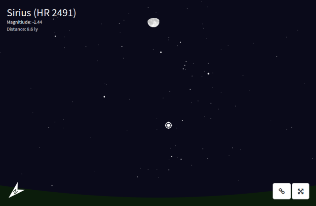
For HopHacks last weekend, I wrote an HTML5 night sky viewer. Using D3.js and SunCalc, the 750 brightest stars are rendered using SVG and Javascript. One’s location can either be found using the HTML5 Geolocation API, or it can be entered manually. The keyboard is used to navigate, and mousing over a star will display some information about it. As it was written in a weekend, there may be bugs.

Here is the viewer:
https://mpetroff.net/files/nightsky/

The code is available on Github.

Night Sky

Posted in | Tagged , , | 1 Comment

Camp Workcoeman Website Redesign

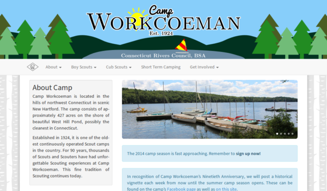
I spent the last few weeks redesigning the Camp Workcoeman website. The site design is based on Bootstrap, without the jQuery components, and makes heavy use of SVGs. In addition, the header dynamically responds to the time of day—the sun’s out during the day, and the stars are out at night. Using SunCalc.js, it fairly accurately displays the sun and moon. Jekyll is used for templating and site generation.

New Site Continue reading

Posted in | Tagged , , , , | 2 Comments

Perambulations and Town Lines

Although abolished a few decades ago, for much of Connecticut’s history colonial, then state law required that towns regularly perambulate their boundaries and establish and renew bounds on said boundaries under penalty of a fine. This was to be done every year at first, before being changed to every three years and then every five years during the 1800s, before being struck from the books. This timetable was not always followed, as I was only able to locate perambulations from 1812, 1849, 1860, and 1914 in the case of the New Hartford and Barkhamsted town line. Perambulations were more frequent in the case of the Winchester and Barkhamsted line, although I only located the 1885, 1900, and 1921 perambulations. I’ve typed both perambulations, making some minor formatting changes and spelling corrections. Here are the New Hartford / Barkhamsted perambulations and the Winchester / Barkhamsted perambulations. Continue reading

Posted in | Tagged , , , , , , | 1 Comment

10 Things that are Like Attributing a Photo on Wikipedia to Wikipedia

Often, people copy images from Wikipedia without citation. Of those who do cite their photos, many just cite “Wikipedia” or “Wikimedia Commons,” which does not attribute the photographer and therefore does not constitute a proper citation. Due to this common mistake, I have compiled a list of ten things that are analogous to only citing “Wikimedia Commons” instead of the photographer when using photos from Wikipedia.

  • Attributing a book you read to the library you borrowed it from
  • Referring to a painting by the art museum it’s hanging in
  • Attributing a speech to the country it was given in
  • Calling a pixel a photograph
  • Attributing Don Quixote to Homo sapiens
  • Calling a brick a building
  • Referring to the cherry on top of your sundae as a sundae
  • Calling “k” the alphabet
  • Referring to 261.6Hz as Sing Sing Sing
  • Calling an atom a car
Incorrect Labels

When using a photo from Wikipedia that has a license that requires attribution, always include the photographer in the citation and preferably link to the source of the photo. The photographer is the copyright holder, not the Wikimedia Foundation, and therefore requires attribution. Also see Wikimedia Commons’ pages on reusing content and credit lines.
Posted in | Tagged , , , | Leave a comment

Camp Workcoeman Land Acquisitions

Since last summer, I’ve been working on a map of Camp Workcoeman. A time consuming aspect of that has been finding and mapping the property bounds, and I’ve spent quite a bit of time researching the deeds for the various parcels. While this gave me an idea of what was acquired when, it was still words, headings, and distances on paper that don’t do the real world geography justice. I have therefore compiled a map of the parcels, including when the camp acquired the land and from whom, which is far more illuminating.

Continue reading

Posted in | Tagged , , , , , | Leave a comment