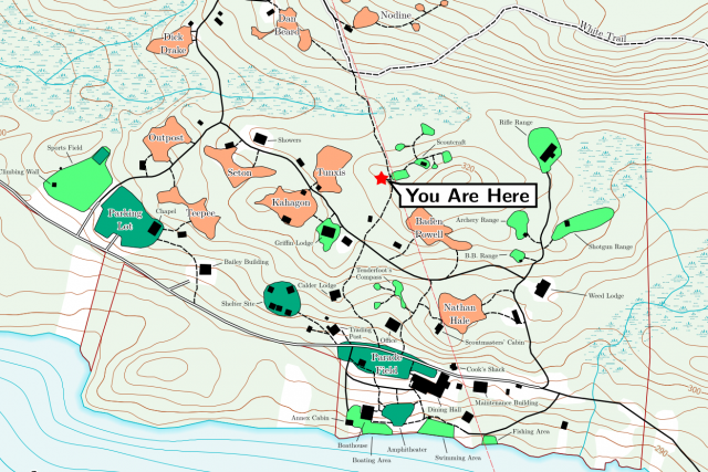
Due to extensive trail work over the past two years, new maps of Camp Workcoeman were needed. Furthermore, the Connecticut statewide spring 2016 orthoimagery was recently released, provide a new data source for updating buildings and land cover. As with my previous mapping, I walked the rerouted trails using a SkyTraq-based receiver that records raw carrier-phase and pseudorange data and post-processed the data using RTKLIB and CORS data from the nearby CTWI site in Winchester. In revising the trail center map, I took the oppertunity to improve it with additional hand-placed labels1 and various minor tweaks.
Updated maps are on the campworkcoeman.org maps page. The data is bundled in the Camp Workcoeman Map App. The web app has been updated, and an update to the Android version, which is fully-offline, is forthcoming.
Auto-label placement still has a long way to go… ↩
